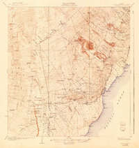
1924 Map of Honuapo
USGS Topo · Published 1943About this map
Kau District is dominated here by the physical legacy of volcanic activity, with the Lava Flow of 1916, Lava Flow of 1887, and Lava Flow of 1868 scarring the landscape. These flows navigate between numerous cinder cones and volcanic features such as Puu Nanaia and Puu o Lokuana. The settlement pattern in the early 1920s shows a concentrated series of plantation camps and ranching outposts, including Wright Camp, Makaelia, and Alapaki Camp, which supported the local agricultural economy near Naalehu.
Find a feature on this map
112 named features on this map. Tap any name to fly to it.
Don’t see what you’re looking for? This feature index may not catch every label — zoom into the map to look around manually.
Map Details
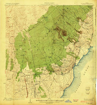
Editions of this 1924 Honuapo Map
3 editions found
Other maps of this area

1921 · Kilauea
USGS Topo · 1:62,500

1923 · Pahala
USGS Topo · 1:62,500

1924 · Kalae
USGS Topo · 1:62,500

1924 · Kilauea
USGS Topo · 1:62,500

1924 · Honuapo
USGS Topo · 1:62,500

1928 · Mauna Loa
USGS Topo · 1:62,500

1928 · Hoopuloa
USGS Topo · 1:62,500

1954 · Hawaii South
USGS Topo · 1:250,000

1959 · Hawaii South
USGS Topo · 1:250,000

1961 · Hawaii South
USGS Topo · 1:250,000