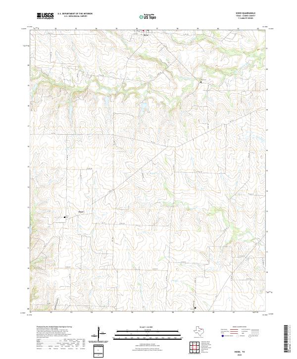
2022 Map of Hood
USGS Topo · Published 2022About this map
The Elm Fork Trinity River winds through the northern portion of this Cooke County landscape, defining a terrain shaped by numerous tributary drainages such as Wildcat Cr and Brushy Elm Cr. This rural environment is anchored by the small settlements of Hood and Myra, which remain connected by a network of farm-to-market roads and county lanes. The presence of established burial grounds, including Hood Cem and Reed Cem, speaks to the long-term family lineages that have inhabited this prairie and creek-cut region. Further south, the map identifies landmarks like Norfleet Hollow and Duck Cr, while Cemetery Rd leads toward Era Cem at the southern edge. The distribution of these features highlights a community built around the cattle and agricultural potential of the North Texas plains, where water sources like Spring Cr and Flat Cr were essential for settlement development.
Find a feature on this map
46 named features on this map. Tap any name to fly to it.
Don’t see what you’re looking for? This feature index may not catch every label — zoom into the map to look around manually.
Map Details
Editions of this 2022 Hood Map
This is the sole edition of this map. No revisions or reprints were ever made.
Other maps of this area

1902 · Gainesville
USGS Topo · 1:125,000

1943 · Gainesville
USGS Topo · 1:125,000

1954 · Sherman
USGS Topo · 1:250,000

1958 · Sherman
USGS Topo · 1:250,000

1960 · Gainesville South
USGS Topo · 1:24,000

1960 · Gainesville North
USGS Topo · 1:24,000

1961 · Muenster West
USGS Topo · 1:24,000

1961 · Freemound
USGS Topo · 1:24,000

1961 · Era
USGS Topo · 1:24,000

1961 · Hood
USGS Topo · 1:24,000