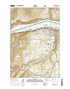
2017 Map of Hood River
USGS Topo · Published 2017About this map
Hood River and the Hood River Valley are the central focus of this survey, where the Columbia River separates Oregon from Washington. The landscape is defined by the agricultural and aviation infrastructure of the early 21st century, featuring the Ken Jernstedt Airfield and the smaller Green Acres Air Park. The map documents a dense concentration of local heritage sites, including Idlewild Cem, Frankton Cem, and the Hood River County Cem.
Find a feature on this map
151 named features on this map. Tap any name to fly to it.
Don’t see what you’re looking for? This feature index may not catch every label — zoom into the map to look around manually.
Map Details
Editions of this 2017 Hood River Map
This is the sole edition of this map. No revisions or reprints were ever made.
Other maps of this area

1926 · Hood River
USGS Topo · 1:125,000

1929 · Hood River
USGS Topo · 1:125,000

1934 · The Dalles
USGS Topo · 1:125,000

1953 · The Dalles
USGS Topo · 1:250,000

1956 · The Dalles
USGS Topo · 1:250,000

1957 · The Dalles
USGS Topo · 1:250,000

1957 · Willard
USGS Topo · 1:62,500

1957 · White Salmon
USGS Topo · 1:62,500

1957 · Husum
USGS Topo · 1:62,500

1957 · Hood River
USGS Topo · 1:62,500