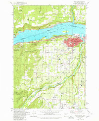
1979 Map of Hood River
USGS Topo · Published 1980About this map
The Columbia River forms a massive corridor through this landscape, marking the border between Skamania and Hood River Counties and defining the commercial life of Hood River. The 1979 survey captures the area's agricultural and industrial infrastructure, from the Powerdale Dam on the Hood River to the Mid Columbia Exper Sta (OSU) and various sewage disposal facilities serving the growing population centers.
Find a feature on this map
76 named features on this map. Tap any name to fly to it.
Don’t see what you’re looking for? This feature index may not catch every label — zoom into the map to look around manually.
Map Details
Editions of this 1979 Hood River Map
This is the sole edition of this map. No revisions or reprints were ever made.
Other maps of this area

1926 · Hood River
USGS Topo · 1:125,000

1929 · Hood River
USGS Topo · 1:125,000

1934 · The Dalles
USGS Topo · 1:125,000

1953 · The Dalles
USGS Topo · 1:250,000

1956 · The Dalles
USGS Topo · 1:250,000

1957 · The Dalles
USGS Topo · 1:250,000

1957 · Willard
USGS Topo · 1:62,500

1957 · White Salmon
USGS Topo · 1:62,500

1957 · Husum
USGS Topo · 1:62,500

1957 · Hood River
USGS Topo · 1:62,500