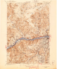
1929 Map of Hood River
USGS Topo · Published 1940About this map
Columbia River commerce and early mountain infrastructure define this mid-1920s survey of the gorge and its surrounding peaks. Before the major hydroelectric projects of the mid-20th century transformed the river, towns like Stevenson, Cascade Locks, and Hood River were anchored by the Union Pacific and S P & S Ry railroads. The newly constructed Columbia River Highway and the Bridge of the Gods represent the dawn of automotive tourism in the region, providing access to landmarks such as Metlako Falls and Blue Lakes.
Find a feature on this map
200 named features on this map. Tap any name to fly to it.
Don’t see what you’re looking for? This feature index may not catch every label — zoom into the map to look around manually.
Map Details
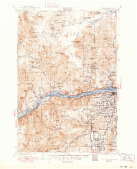
Editions of this 1929 Hood River Map
3 editions found
Other maps of this area

1904 · Mount Adams
USGS Topo · 1:125,000

1907 · Mount Adams
USGS Topo · 1:125,000

1916 · Estacada
USGS Topo · 1:125,000

1919 · Mount St Helens
USGS Topo · 1:125,000

1924 · Mount Hood
USGS Topo · 1:125,000

1926 · Steamboat Mtn
USGS Topo · 1:125,000

1926 · Hood River
USGS Topo · 1:125,000

1927 · Mount Hood
USGS Topo · 1:125,000

1929 · Hood River
USGS Topo · 1:125,000

1930 · Dufur
USGS Topo · 1:125,000