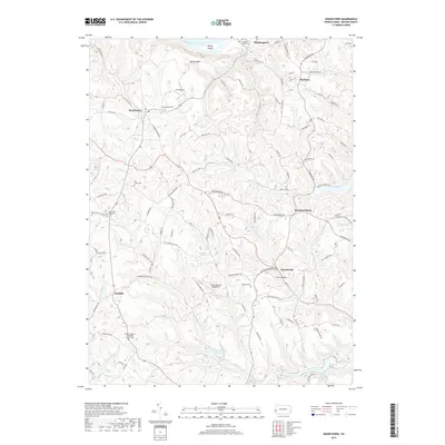
2019 Map of Hookstown
USGS Topo · Published 2019About this map
Hookstown serves as a primary inland hub on this Beaver County terrain, where a network of rural routes like Georgetown Rd and Pittsburgh Grade Rd converge. The landscape is defined by the deep incisions of Service Cr and the Little Service Run, which flow through heavily wooded valleys toward the Ohio River at the northern boundary. Along the river, Phillis Island and the Wallory Bar reflect the shifting hydrology of the waterway near Shippingport. Local aviation history is notable here, with three distinct private or small-scale airstrips identified: Fino Airport, McCoy Airport, and Hanny Beaver Airpark Inc. Genealogy researchers can find numerous small burial grounds across the townships, ranging from the Christler Family Cem in the north to the Bethel Church Cem and Hanover Cem further south, illustrating the dispersed nature of these early settlements.
Find a feature on this map
115 named features on this map. Tap any name to fly to it.
Don’t see what you’re looking for? This feature index may not catch every label — zoom into the map to look around manually.
Map Details
Editions of this 2019 Hookstown Map
This is the sole edition of this map. No revisions or reprints were ever made.
Other maps of this area

1901 · Beaver
USGS Topo · 1:62,500

1904 · Wellsville
USGS Topo · 1:62,500

1904 · Steubenville
USGS Topo · 1:62,500

1904 · Beaver
USGS Topo · 1:62,500

1904 · Burgettstown
USGS Topo · 1:62,500

1906 · Burgettstown
USGS Topo · 1:62,500

1935 · Steubenville
USGS Topo · 1:62,500

1937 · Wellsville
USGS Topo · 1:62,500

1942 · Steubenville
USGS Topo · 1:62,500

1944 · Wellsville
USGS Topo · 1:62,500
Featured Places
- Hookstown, PA
- Greene Township, PA
- Raccoon Township, PA
- Hanover Township, PA
- Harshaville, Hanover Township