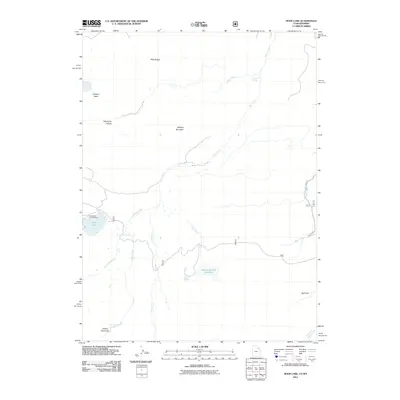
2011 Map of Hoop Lake
USGS Topo · Published 2011About this map
Burnt Fork meanders through this high-altitude landscape on the Wyoming and Utah border, where water management and recreation define the local geography. The presence of Beaver Meadow Reservoir and Hoop Lake indicates the importance of mountain water resources in this arid region. Significant terrain features like the Bald Range, Widdop Mountain, and the tucked-away Gregory Basin dominate the northern half of the quadrangle, while Telephone Hollow suggests early communication corridors through the peaks. To the south, Kabell Meadows and the Hoop Lake Campground highlight the area's use for grazing and seasonal outdoor activity. The drainage network is dense, with Thompson Creek, Kabell Creek, and Lost Creek feeding into the larger systems that define the watershed near the turn of the 21st century.
Find a feature on this map
19 named features on this map. Tap any name to fly to it.
Don’t see what you’re looking for? This feature index may not catch every label — zoom into the map to look around manually.
Map Details
Editions of this 2011 Hoop Lake Map
This is the sole edition of this map. No revisions or reprints were ever made.
Other maps of this area

1885 · Ashley
USGS Topo · 1:250,000

1885 · Uinta
USGS Topo · 1:250,000

1905 · Gilbert Peak
USGS Topo · 1:125,000

1906 · Gilbert Peak
USGS Topo · 1:125,000

1906 · Marsh Peak
USGS Topo · 1:125,000

1908 · Marsh Peak
USGS Topo · 1:125,000

1954 · Salt Lake City
USGS Topo · 1:250,000

1954 · Vernal
USGS Topo · 1:250,000

1954 · Ogden
USGS Topo · 1:250,000

1954 · Rock Springs
USGS Topo · 1:250,000