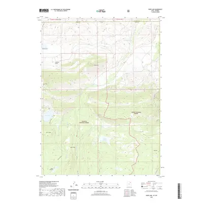
2020 Map of Hoop Lake
USGS Topo · Published 2020About this map
Wasatch National Forest and Ashley National Forest dominate this high-elevation landscape along the border of Utah and Wyoming. The map documents a complex drainage system where Indian Cr and the Burnt Fork move through the northern foothills of the Bald Range. Notable water features include the Beaver Meadow Reservoir, Hoop Lake, and Fish Lake, which serve as critical landmarks for local hydrologic history. Evidence of past resource extraction is visible at Coal Mine Hill, while numerous family-named landmarks like Widdop Mtn, Gregory Basin, and Kabell Ridge suggest the deep-rooted history of ranching and early settlement in this corner of Sweetwater and Uinta Counties.
Find a feature on this map
28 named features on this map. Tap any name to fly to it.
Don’t see what you’re looking for? This feature index may not catch every label — zoom into the map to look around manually.
Map Details
Editions of this 2020 Hoop Lake Map
This is the sole edition of this map. No revisions or reprints were ever made.
Other maps of this area

1885 · Ashley
USGS Topo · 1:250,000

1885 · Uinta
USGS Topo · 1:250,000

1905 · Gilbert Peak
USGS Topo · 1:125,000

1906 · Gilbert Peak
USGS Topo · 1:125,000

1906 · Marsh Peak
USGS Topo · 1:125,000

1908 · Marsh Peak
USGS Topo · 1:125,000

1954 · Salt Lake City
USGS Topo · 1:250,000

1954 · Vernal
USGS Topo · 1:250,000

1954 · Ogden
USGS Topo · 1:250,000

1954 · Rock Springs
USGS Topo · 1:250,000