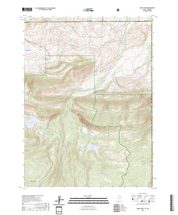
2023 Map of Hoop Lake
USGS Topo · Published 2023About this map
The Bald Range and Widdop Mtn dominate this high-altitude landscape along the border of Utah and Wyoming. The settlement of Lonetree is positioned at the northern edge of the map, just south of the Wyoming state line, where the terrain transitions toward the more rugged topography of the Wasatch National Forest and Ashley National Forest. These lands are characterized by a dense network of watercourses and recreational trails, including the Burnt Ridge Trl and Kabell Meadows Trl, which provide access to remote landmarks like Hoop Lake and Beaver Meadow Reservoir. Historically, the presence of labels such as Telephone Hollow suggests early communication infrastructure, while named features like Kabell Meadows and Bull Park point to established grazing or camping locations within the High Uintas Wilderness. The map records a complex drainage system where Burnt Fork and Birch Creek carve through the ridges of the Uinta Mountains.
Find a feature on this map
29 named features on this map. Tap any name to fly to it.
Don’t see what you’re looking for? This feature index may not catch every label — zoom into the map to look around manually.
Map Details
Editions of this 2023 Hoop Lake Map
This is the sole edition of this map. No revisions or reprints were ever made.
Other maps of this area

1885 · Ashley
USGS Topo · 1:250,000

1885 · Uinta
USGS Topo · 1:250,000

1905 · Gilbert Peak
USGS Topo · 1:125,000

1906 · Gilbert Peak
USGS Topo · 1:125,000

1906 · Marsh Peak
USGS Topo · 1:125,000

1908 · Marsh Peak
USGS Topo · 1:125,000

1954 · Salt Lake City
USGS Topo · 1:250,000

1954 · Vernal
USGS Topo · 1:250,000

1954 · Ogden
USGS Topo · 1:250,000

1954 · Rock Springs
USGS Topo · 1:250,000