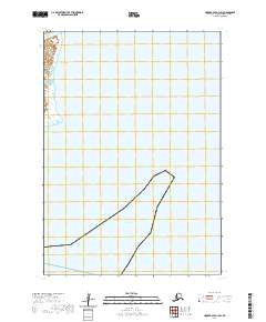
2020 Map of Hooper Bay A-1 SW
USGS Topo · Published 2020About this map
Apothluk River meanders through the coastal lowlands of the Kusilvak Census Area in this remote section of the Hooper Bay region. The landscape is defined by vast hydrographic networks and seasonal wetlands characteristic of the Yukon-Kuskokwim Delta. In the southern portion of the map, the shoreline meets the tidal waters of Hazen Bay, reflecting the transition from inland tundra to the Bering Sea coast. The township and range lines of t12n r91w and t11n r90w provide a grid over this largely roadless terrain, where the natural water systems remain the primary geographic landmarks for navigation and local land use.
Find a feature on this map
6 named features on this map. Tap any name to fly to it.
Don’t see what you’re looking for? This feature index may not catch every label — zoom into the map to look around manually.
Map Details
Editions of this 2020 Hooper Bay A-1 SW Map
This is the sole edition of this map. No revisions or reprints were ever made.
Other maps of this area

1951 · Hooper Bay
USGS Topo · 1:250,000

1951 · Nunivak Island
USGS Topo · 1:250,000
1952 · Hooper Bay A-2
USGS Topo · 1:63,360

1953 · Hooper Bay
USGS Topo · 1:250,000

1954 · Nunivak Island
USGS Topo · 1:250,000
1954 · Hooper Bay A-1
USGS Topo · 1:63,360
1954 · Nunivak Island D-1
USGS Topo · 1:63,360

1958 · Nunivak Island
USGS Topo · 1:250,000

1964 · Nunivak Island
USGS Topo · 1:250,000

1964 · Hooper Bay
USGS Topo · 1:250,000