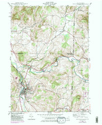
2023 Map of Hoosick Falls
USGS Topo · Published 2023About this map
Hoosick Falls and its surrounding river valleys define this borderlands landscape where New York and Vermont meet. The Hoosic River and Walloomsac River converge near the western edge, a geographic bottleneck that historically facilitated transportation, now traced by the Pan Am Southern railroad and the cluster of settlements at Hoosick Junction and North Hoosick. The terrain rises sharply toward the northeast into the Green Mountain National Forest, where the slopes of West Mtn and the narrow valley of Shaftsbury Hollow contrast with the broader agricultural flats to the south.
Find a feature on this map
129 named features on this map. Tap any name to fly to it.
Don’t see what you’re looking for? This feature index may not catch every label — zoom into the map to look around manually.
Map Details
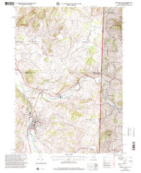
Editions of this 2023 Hoosick Falls Map
This is the sole edition of this map. No revisions or reprints were ever made.
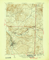
Historical Maps of Hoosick Through Time
4 maps found