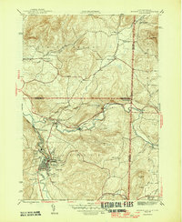
1946 Map of Hoosick Falls
USGS Topo · Published 1946About this map
The Walloomsac River and Hoosic River converge in this mid-century portrait of the New York and Vermont borderlands. The landscape is defined by its deep historical roots, notably the Bennington Battlefield Park, which commemorates the 1777 Revolutionary War site. A robust rail infrastructure is evident through the routes of the Boston and Maine and Rutland railroads, which served industrial hubs like Hoosick Falls and smaller settlements such as North Hoosick and Hoosick Junction.
Find a feature on this map
39 named features on this map. Tap any name to fly to it.
Don’t see what you’re looking for? This feature index may not catch every label — zoom into the map to look around manually.
Map Details
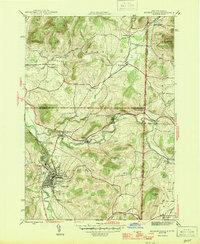
Editions of this 1946 Hoosick Falls Map
2 editions found
Other maps of this area

1894 · Equinox
USGS Topo · 1:62,500

1895 · Cambridge
USGS Topo · 1:62,500

1896 · Equinox
USGS Topo · 1:62,500

1897 · Hoosick
USGS Topo · 1:62,500

1898 · Cambridge
USGS Topo · 1:62,500

1898 · Bennington
USGS Topo · 1:62,500

1900 · Taconic
USGS Topo · 1:125,000

1900 · Equinox
USGS Topo · 1:62,500

1901 · Cambridge
USGS Topo · 1:62,500

1903 · Mettawee
USGS Topo · 1:125,000