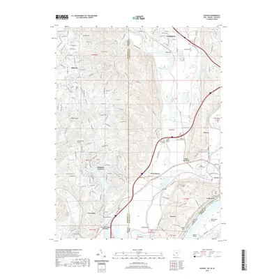
2019 Map of Hooven
USGS Topo · Published 2019About this map
The Whitewater River and Great Miami River converge in this tri-state corridor where Ohio, Indiana, and Kentucky meet. The landscape is defined by the high ground of Harrison Hill and Jackson Ridge overlooking the fertile North Bend Bottom and Bullitts Bottom along the Ohio River. Significant local history is preserved at the William Henry Harrison Memorial in North Bend, while numerous rural burial grounds like Miller-Hayes Cem and Sugar Ridge Cem dot the uplands. Infrastructure varies from the modern corridors of I-74 to the smaller Lost Bridge Airport and the historic Long Island Suspension Bridge. The map details a transition from the denser settlement of Harrison and Bright to the industrial and transit-oriented hubs of Hooven, Valley Junction, and Lawrenceburg Junction, reflecting the area's long-standing role as a crossroads for river and rail transportation.
Find a feature on this map
66 named features on this map. Tap any name to fly to it.
Don’t see what you’re looking for? This feature index may not catch every label — zoom into the map to look around manually.
Map Details
Editions of this 2019 Hooven Map
This is the sole edition of this map. No revisions or reprints were ever made.
Other maps of this area

1914 · West Cincinnati
USGS Topo · 1:62,500

1915 · Lawrenceburg
USGS Topo · 1:48,000

1915 · Harrison
USGS Topo · 1:48,000

1915 · Hamilton
USGS Topo · 1:62,500

1917 · Hamilton
USGS Topo · 1:62,500

1928 · Lawrenceburg
USGS Topo · 1:62,500

1932 · Lawrenceburg
USGS Topo · 1:62,500

1943 · Aurora
USGS Topo · 1:24,000

1943 · Hooven
USGS Topo · 1:24,000

1943 · Guilford
USGS Topo · 1:24,000