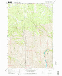
1967 Map of Hoover Point
USGS Topo · Published 1979About this map
Deer Creek Mine sits within the drainage of Deer Creek, highlighting a landscape shaped by early resource extraction and timber transport. This 1967 survey of the border between Nez Perce County and Lewis County reveals a significant network of defunct transit, marked by an extensive Old Railroad Grade and Old RR Grade that wind through the complex terrain. These tracks once served the industrial needs of the region, connecting the high country near Hoover Point to the drainages below.
Find a feature on this map
18 named features on this map. Tap any name to fly to it.
Don’t see what you’re looking for? This feature index may not catch every label — zoom into the map to look around manually.
Map Details
Editions of this 1967 Hoover Point Map
2 editions found
Other maps of this area

1946 · Limekiln Rapids
USGS Topo · 1:62,500

1955 · Pullman
USGS Topo · 1:250,000

1955 · Grangeville
USGS Topo · 1:250,000

1958 · Pullman
USGS Topo · 1:250,000

1959 · Grangeville
USGS Topo · 1:250,000

1963 · Boles
USGS Topo · 1:24,000

1963 · Rattlesnake Ridge
USGS Topo · 1:24,000

1963 · Wapshilla Creek
USGS Topo · 1:24,000

1967 · Hoover Point
USGS Topo · 1:24,000

1967 · Westlake
USGS Topo · 1:24,000