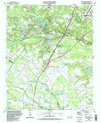
1986 Map of Hope Mills
USGS Topo · Published 1987About this map
Hope Mills serves as the central hub of this 1980s landscape, positioned where the waters of Little Rockfish Creek and Buckhead Creek converge at Hope Mills Lake. The surrounding Cumberland County countryside reveals a complex network of small settlements and transportation corridors, including Colonial Heights, Roslin, and McMillan. The presence of several Sandpits indicates the local industrial activity of the era, while the transition from active rail lines like the CSX Railroad to an Old RR Gr suggests a changing logistics landscape.
Find a feature on this map
58 named features on this map. Tap any name to fly to it.
Don’t see what you’re looking for? This feature index may not catch every label — zoom into the map to look around manually.
Map Details
Editions of this 1986 Hope Mills Map
2 editions found
Other maps of this area

1948 · Fayetteville
USGS Topo · 1:62,500

1948 · Clifdale
USGS Topo · 1:62,500

1948 · Clifdale
USGS Topo · 1:24,000

1949 · Vander
USGS Topo · 1:24,000

1950 · Clifdale
USGS Topo · 1:24,000

1950 · Fayetteville
USGS Topo · 1:24,000

1951 · Clifdale
USGS Topo · 1:62,500

1953 · Florence
USGS Topo · 1:250,000

1953 · Raleigh
USGS Topo · 1:250,000

1954 · Florence
USGS Topo · 1:250,000