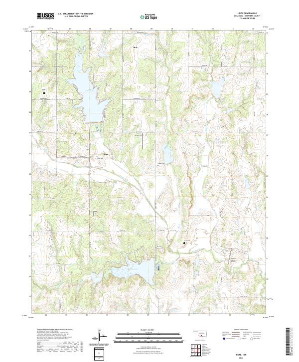
2022 Map of Hope
USGS Topo · Published 2022About this map
Hope and Bray anchor this section of Stephens County, where the landscape is defined by a series of reservoirs and creek valleys. Clear Creek Lake dominates the northern terrain, supported by Clear Cr and Bluff Cr, while Duncan Lake and the 137073 Reservoir lie to the south. The area maintains a rural character structured around the Public Land Survey System, with roads like Renfrow Rd and Camelback Rd tracing section lines. Local genealogy is well-represented by several family or community burial grounds, including Hope Cem, Colbert Cem, Cruce Cem, and Cooper Cem. The presence of Wolfe Field and Ketchum Ranch Airport suggests a reliance on small-scale aviation for agricultural or ranching operations within these townships.
Find a feature on this map
63 named features on this map. Tap any name to fly to it.
Don’t see what you’re looking for? This feature index may not catch every label — zoom into the map to look around manually.
Map Details
Editions of this 2022 Hope Map
This is the sole edition of this map. No revisions or reprints were ever made.
Other maps of this area

1901 · Addington
USGS Topo · 1:125,000

1902 · Rush Springs
USGS Topo · 1:125,000

1950 · Marlow
USGS Topo · 1:62,500

1951 · Marlow
USGS Topo · 1:62,500

1957 · Ardmore
USGS Topo · 1:250,000

1963 · Ardmore
USGS Topo · 1:250,000

1963 · Harrisburg
USGS Topo · 1:24,000

1964 · Duncan South
USGS Topo · 1:24,000
1974 · Cox City
USGS Topo · 1:24,000
1974 · Velma
USGS Topo · 1:24,000