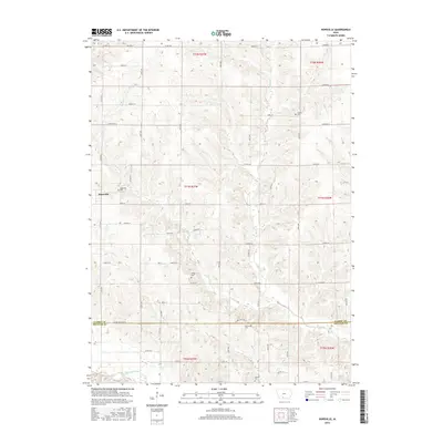
2015 Map of Hopeville
USGS Topo · Published 2015About this map
The unincorporated settlement of Hopeville anchors this landscape on the border of Clarke and Decatur counties, where rural life is defined by the winding tributaries of the Thompson River. The area is characterized by a grid of agricultural section roads such as Doyle St and Church St that navigate the rolling terrain between W Long Cr and E Long Cr. Several family and community burial grounds, including Hopeville Cem, Warrick Cem, and Sanders Cem, are scattered across these townships, serving as vital landmarks for genealogical research and local history. The southern edge of the survey follows the Clarke Co Decatur Co line, illustrating the persistent importance of early political boundaries in shaping the modern Iowa countryside. This 2015 data reflects the enduring rural character of southern Iowa, where small creeks like Short Cr and Long Cr dictate the layout of farmsteads and field patterns.
Find a feature on this map
50 named features on this map. Tap any name to fly to it.
Don’t see what you’re looking for? This feature index may not catch every label — zoom into the map to look around manually.
Map Details
Editions of this 2015 Hopeville Map
This is the sole edition of this map. No revisions or reprints were ever made.
Other maps of this area

1951 · Osceola
USGS Topo · 1:62,500

1951 · Afton
USGS Topo · 1:62,500

1954 · Centerville
USGS Topo · 1:250,000

1954 · Omaha
USGS Topo · 1:250,000

1954 · Des Moines
USGS Topo · 1:250,000

1955 · Nebraska City
USGS Topo · 1:250,000

1956 · Des Moines
USGS Topo · 1:250,000

1957 · Des Moines
USGS Topo · 1:250,000

1957 · Nebraska City
USGS Topo · 1:250,000

1957 · Omaha
USGS Topo · 1:250,000