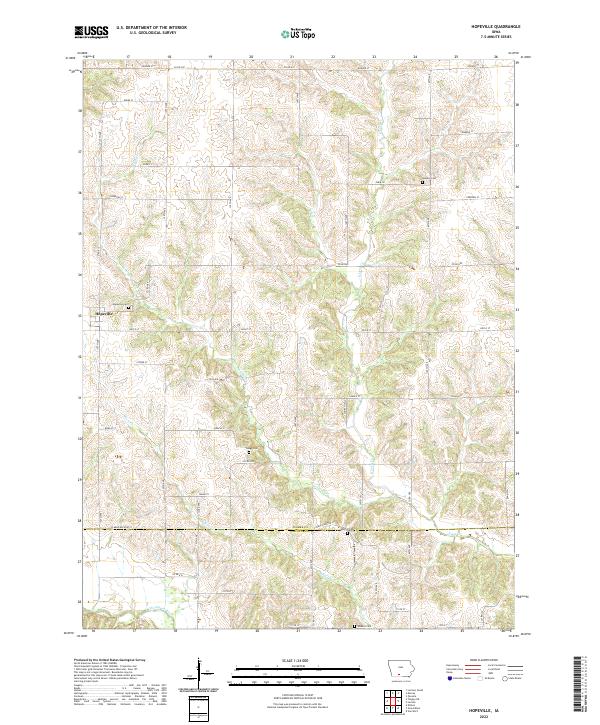
2022 Map of Hopeville
USGS Topo · Published 2022About this map
Hopeville anchors this rural landscape along the boundary of Clarke and Decatur Counties, where the terrain is defined by a dense network of tributaries feeding into the Thompson River. The area's settlement history is reflected in its numerous scattered burial grounds, including Sanders Cem, Gregg Cem, and Wheelis Cem, which provide specific points of interest for genealogists tracing local families. The drainage patterns of W Long Cr, E Long Cr, and Short Cr have dictated a road grid that frequently deviates from strict cardinal directions to navigate the shifting elevations of the Southern Iowa Drift Plain. This 2022 edition documents the enduring rural character of the region, where legacy property boundaries and small community centers like the Hopeville Cem remain central landmarks amidst the agricultural fields.
Find a feature on this map
50 named features on this map. Tap any name to fly to it.
Don’t see what you’re looking for? This feature index may not catch every label — zoom into the map to look around manually.
Map Details
Editions of this 2022 Hopeville Map
This is the sole edition of this map. No revisions or reprints were ever made.
Other maps of this area

1951 · Osceola
USGS Topo · 1:62,500

1951 · Afton
USGS Topo · 1:62,500

1954 · Centerville
USGS Topo · 1:250,000

1954 · Omaha
USGS Topo · 1:250,000

1954 · Des Moines
USGS Topo · 1:250,000

1955 · Nebraska City
USGS Topo · 1:250,000

1956 · Des Moines
USGS Topo · 1:250,000

1957 · Des Moines
USGS Topo · 1:250,000

1957 · Nebraska City
USGS Topo · 1:250,000

1957 · Omaha
USGS Topo · 1:250,000