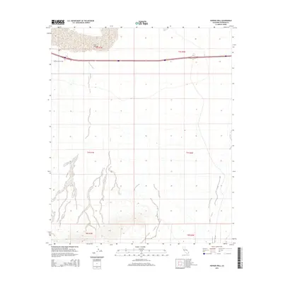
2015 Map of Hopkins Well
USGS Topo · Published 2015About this map
Hopkins Well sits as a primary reference point in this arid stretch of the Colorado Desert. The landscape is dominated by the sprawling basin of Ford Dry Lake, which anchors the northern portion of the survey area. This 2015 USGS survey illustrates the modern transportation corridors that cross the Chuckwalla Valley, including the arterial Chuckwalla Valley Rd and the north-south transit of Wiley's Well Rd. The map provides a detailed view of the township and range divisions, such as t7s r19e and t7s r20e, which define property and administrative boundaries across the basin floor. The drainage patterns from the surrounding uplands suggest a complex alluvial environment where seasonal runoff feeds toward the central dry lake bed.
Find a feature on this map
10 named features on this map. Tap any name to fly to it.
Don’t see what you’re looking for? This feature index may not catch every label — zoom into the map to look around manually.
Map Details
Editions of this 2015 Hopkins Well Map
This is the sole edition of this map. No revisions or reprints were ever made.
Other maps of this area

1942 · Blythe
USGS Topo · 1:250,000

1952 · Mc Coy Spring
USGS Topo · 1:62,500

1952 · Sidewinder Well
USGS Topo · 1:62,500

1953 · Palo Verde Mountains
USGS Topo · 1:62,500

1953 · Chuckwalla Spring
USGS Topo · 1:62,500

1954 · Salton Sea
USGS Topo · 1:250,000

1955 · Salton Sea
USGS Topo · 1:250,000

1959 · Salton Sea
USGS Topo · 1:250,000

1963 · Salton Sea
USGS Topo · 1:250,000

1965 · Salton Sea
USGS Topo · 1:250,000