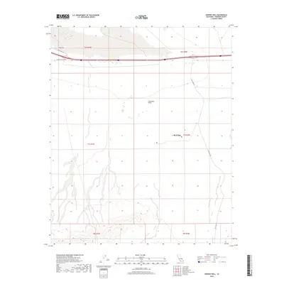
2018 Map of Hopkins Well
USGS Topo · Published 2018About this map
The arid expanse of the Chuckwalla Valley dominates this 2018 survey, centered on the historic waypoint of Hopkins Well. Located west of Blythe in Riverside County, the landscape is defined by the stark geometry of desert infrastructure and the drainage patterns of the Colorado Desert. Modern transportation corridors, including Chuckwalla Valley Rd and Wileys Well Rd, intersect the township and range lines of the Public Land Survey System, illustrating how 21st-century travel follows the established grid of the American West. The map captures the interface between the open valley floor and the sand systems represented by Palen Dunes Dr, providing a technical look at a region where water sources like Hopkins Well were once essential for travel across the desert long before the paving of the current highway system.
Find a feature on this map
12 named features on this map. Tap any name to fly to it.
Don’t see what you’re looking for? This feature index may not catch every label — zoom into the map to look around manually.
Map Details
Editions of this 2018 Hopkins Well Map
This is the sole edition of this map. No revisions or reprints were ever made.
Other maps of this area

1942 · Blythe
USGS Topo · 1:250,000

1952 · Mc Coy Spring
USGS Topo · 1:62,500

1952 · Sidewinder Well
USGS Topo · 1:62,500

1953 · Palo Verde Mountains
USGS Topo · 1:62,500

1953 · Chuckwalla Spring
USGS Topo · 1:62,500

1954 · Salton Sea
USGS Topo · 1:250,000

1955 · Salton Sea
USGS Topo · 1:250,000

1959 · Salton Sea
USGS Topo · 1:250,000

1963 · Salton Sea
USGS Topo · 1:250,000

1965 · Salton Sea
USGS Topo · 1:250,000