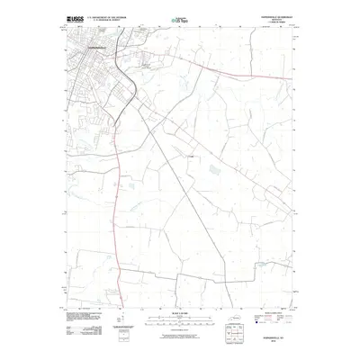
2010 Map of Hopkinsville
USGS Topo · Published 2010About this map
Hopkinsville sits at the confluence of the North Fork Little River and South Fork Little River in this detailed 2010 survey. The map documents the city's modern infrastructure, from the Edward T Breathitt Pennyrile Pkwy to the Hopkinsville-Christian County Airport. While urban development dominates the northwest, the landscape transitions into a network of rural routes such as Terry Stokes Rd and John Rivers Rd. Significant local landmarks for genealogists include Riverside Cemetery and Cave Spring Cemetery, alongside the smaller settlement of Casky. The hydrography of the southern region is defined by Rock Bridge Branch and Long Pond, reflecting the karst-influenced terrain typical of Christian County. The map provides a clear look at how the Hopkinsville Byp and Eagle Way have restructured the local traffic patterns around the historic city center.
Find a feature on this map
29 named features on this map. Tap any name to fly to it.
Don’t see what you’re looking for? This feature index may not catch every label — zoom into the map to look around manually.
Map Details
Editions of this 2010 Hopkinsville Map
This is the sole edition of this map. No revisions or reprints were ever made.
Other maps of this area

1944 · Clarksville
USGS Topo · 1:50,000

1950 · Pembroke
USGS Topo · 1:24,000

1951 · Pembroke
USGS Topo · 1:24,000

1951 · Church Hill
USGS Topo · 1:24,000

1951 · Hopkinsville
USGS Topo · 1:24,000

1951 · Hammacksville
USGS Topo · 1:24,000

1951 · Herndon
USGS Topo · 1:24,000

1951 · Oak Grove
USGS Topo · 1:24,000

1952 · Pleasant Green Hill
USGS Topo · 1:24,000

1952 · Kelly
USGS Topo · 1:24,000