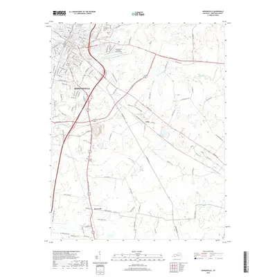
2019 Map of Hopkinsville
USGS Topo · Published 2019About this map
Hopkinsville sits at the convergence of the N Fork Little River and the S Fork Little River, forming a central hub for Christian County. This survey reveals the modern infrastructure of the city, including the grid of the historic core with streets like S Main St and E 9th St, as well as its expansion toward the Hopkinsville-Christian County Airport. The landscape outside the city center transitions into smaller communities such as Casky to the east and Masonville to the south. Significant local landmarks, including the Kentucky Veteran's Cem West and the Cave Spring Cem, are clearly delineated. The mapping of water features like Rock Bridge Br and Long Pond shows the persistent drainage patterns that have influenced settlement and agriculture in this part of the Pennyroyal Plateau for generations.
Find a feature on this map
120 named features on this map. Tap any name to fly to it.
Don’t see what you’re looking for? This feature index may not catch every label — zoom into the map to look around manually.
Map Details
Editions of this 2019 Hopkinsville Map
This is the sole edition of this map. No revisions or reprints were ever made.
Other maps of this area

1944 · Clarksville
USGS Topo · 1:50,000

1950 · Pembroke
USGS Topo · 1:24,000

1951 · Pembroke
USGS Topo · 1:24,000

1951 · Church Hill
USGS Topo · 1:24,000

1951 · Hopkinsville
USGS Topo · 1:24,000

1951 · Hammacksville
USGS Topo · 1:24,000

1951 · Herndon
USGS Topo · 1:24,000

1951 · Oak Grove
USGS Topo · 1:24,000

1952 · Pleasant Green Hill
USGS Topo · 1:24,000

1952 · Kelly
USGS Topo · 1:24,000