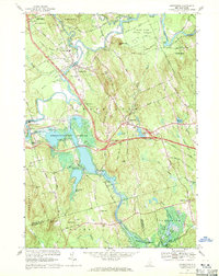
1967 Map of Hopkinton
USGS Topo · Published 1971About this map
The Contoocook River dominates this landscape, winding through a complex network of reservoirs and flood control areas during the late 1960s. The completion of the Hopkinton Dam and the resulting Hopkinton-Everett Reservoir fundamentally altered the local topography, creating sprawling inundation zones like the Stumpfield Marsh. This engineering era is juxtaposed with older New England landmarks, including a Covered Bridge and the Fairgrounds near Contoocook.
Find a feature on this map
65 named features on this map. Tap any name to fly to it.
Don’t see what you’re looking for? This feature index may not catch every label — zoom into the map to look around manually.
Map Details
Editions of this 1967 Hopkinton Map
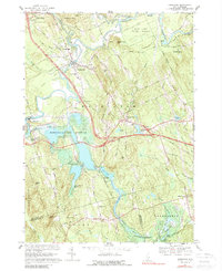
2 editions found
Other maps of this area

1926 · Hillsboro
USGS Topo · 1:62,500

1927 · Concord
USGS Topo · 1:62,500

1927 · Penacook
USGS Topo · 1:62,500

1928 · Mount Kearsarge
USGS Topo · 1:62,500

1929 · Hillsboro
USGS Topo · 1:62,500

1931 · Mount Kearsarge
USGS Topo · 1:62,500

1949 · Portland
USGS Topo · 1:250,000

1949 · Concord
USGS Topo · 1:62,500

1956 · Penacook
USGS Topo · 1:62,500

1956 · Mt. Kearsarge
USGS Topo · 1:62,500