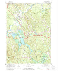
1967 Map of Hopkinton
USGS Topo · Published 1989About this map
The Contoocook River winds through this Merrimack County landscape, defining a region where colonial-era settlement patterns meet mid-century infrastructure. The village of Contoocook stands as a primary hub, featuring a High Sch, the Maple Street Sch, and the local Fairgrounds. To the west, the village of West Hopkinton sits near the Hopkinton Dam, which manages the waters of the Hopkinton-Everett Reservoir.
Find a feature on this map
83 named features on this map. Tap any name to fly to it.
Don’t see what you’re looking for? This feature index may not catch every label — zoom into the map to look around manually.
Map Details
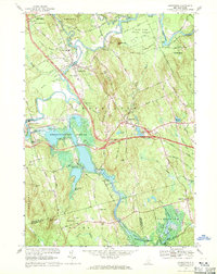
Editions of this 1967 Hopkinton Map
2 editions found
Other maps of this area

1926 · Hillsboro
USGS Topo · 1:62,500

1927 · Concord
USGS Topo · 1:62,500

1927 · Penacook
USGS Topo · 1:62,500

1928 · Mount Kearsarge
USGS Topo · 1:62,500

1929 · Hillsboro
USGS Topo · 1:62,500

1931 · Mount Kearsarge
USGS Topo · 1:62,500

1949 · Portland
USGS Topo · 1:250,000

1949 · Concord
USGS Topo · 1:62,500

1956 · Penacook
USGS Topo · 1:62,500

1956 · Mt. Kearsarge
USGS Topo · 1:62,500