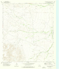
1973 Map of Hopper Draw East
USGS Topo · Published 1976About this map
Arid grazing and resource extraction lands define this West Texas landscape, mapped by photogrammetric methods from aerial photographs taken in 1972. The survival of industry and livestock in this dry terrain is marked by essential water infrastructure, including West Well, Corner Well, and the prominent Axtell Windmill. These isolated points of reliability are connected by an extensive Pipeline cutting across the northern reaches, while the natural drainage is defined by seasonal watercourses like Hart Draw, Hopper Draw, and Hurds Pass Draw. The presence of several Drill Hole locations suggests active subsurface exploration during the early 1970s. Topographic relief is most pronounced in the southwestern corner, contrasting with the flatter areas surrounding the label Toy and the various tanks and wells that served as the lifeblood for local ranching operations in Culberson County.
Find a feature on this map
11 named features on this map. Tap any name to fly to it.
Don’t see what you’re looking for? This feature index may not catch every label — zoom into the map to look around manually.
Map Details
Editions of this 1973 Hopper Draw East Map
This is the sole edition of this map. No revisions or reprints were ever made.
Other maps of this area

1928 · Kent
USGS Topo · 1:125,000

1954 · Van Horn
USGS Topo · 1:250,000

1958 · Van Horn
USGS Topo · 1:250,000
1970 · Panther Canyon
USGS Topo · 1:24,000
1970 · San Martine
USGS Topo · 1:24,000
1970 · Iron Mountain
USGS Topo · 1:24,000

1973 · Dellahunt Draw West
USGS Topo · 1:24,000
1973 · Burnt Spring Hills SE
USGS Topo · 1:24,000
1973 · Dellahunt Draw East
USGS Topo · 1:24,000
1973 · Burnt Spring Hills
USGS Topo · 1:24,000