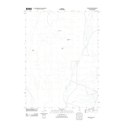
2011 Map of Hoppin Peaks
USGS Topo · Published 2011About this map
The Quinn River meanders across this high desert landscape, defining the hydrology of a region where water sources are vital but sparse. To the west, the Sentinel Hills rise above the basin floor, while the central terrain is dominated by the elevations of Hoppin Peaks and Salient Peak. These landmarks serve as critical navigational points in a topography characterized by dry canyons and seasonal drainages, such as Chokecherry Canyon and Skull Creek. Sparse infrastructure is represented by Flat Creek Rd in the southeast, reflecting the isolated nature of this area in the early 21st century. Cherry Spring provides one of the few named water points in the higher elevations, highlighting the traditional importance of specific springs for livestock and wildlife in the Great Basin.
Find a feature on this map
8 named features on this map. Tap any name to fly to it.
Don’t see what you’re looking for? This feature index may not catch every label — zoom into the map to look around manually.
Map Details
Editions of this 2011 Hoppin Peaks Map
This is the sole edition of this map. No revisions or reprints were ever made.
Other maps of this area

1882 · Paradise
USGS Topo · 1:250,000

1893 · Paradise
USGS Topo · 1:250,000

1955 · McDermitt
USGS Topo · 1:250,000

1959 · McDermitt
USGS Topo · 1:250,000

1959 · Orovada
USGS Topo · 1:62,500

1959 · McDermitt
USGS Topo · 1:62,500

1959 · Hinkey Summit
USGS Topo · 1:62,500

1959 · Jordan Meadow
USGS Topo · 1:62,500

1985 · Quinn River Valley
USGS Topo · 1:100,000
1991 · Hoppin Peaks
USGS Topo · 1:24,000