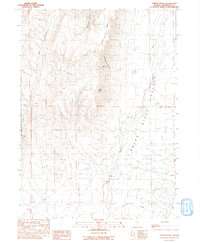
1991 Map of Hoppin Peaks
USGS Topo · Published 1991About this map
Hoppin Peaks and Salient Peak dominate the western terrain of this Humboldt County quadrangle, where the steep relief of Chokecherry Canyon and McConnell Canyon gives way to the broad floor of Quinn Valley. The hydrological network is the focal point of the area's development, featuring the winding course of the Quinn River and its tributaries like Skull Creek and Flat Creek. This 1991 provisional survey captures a landscape defined by water management and resource extraction, notably marked by a Gaging Station on the river and a Borrow Pit in the valley. High-altitude water sources such as Cherry Spring contrast with the engineered Stock Pond at lower elevations, illustrating the essential infrastructure required for survival and industry in this arid environment.
Find a feature on this map
21 named features on this map. Tap any name to fly to it.
Don’t see what you’re looking for? This feature index may not catch every label — zoom into the map to look around manually.
Map Details
Editions of this 1991 Hoppin Peaks Map
This is the sole edition of this map. No revisions or reprints were ever made.
Other maps of this area

1882 · Paradise
USGS Topo · 1:250,000

1893 · Paradise
USGS Topo · 1:250,000

1955 · McDermitt
USGS Topo · 1:250,000

1959 · McDermitt
USGS Topo · 1:250,000

1959 · Orovada
USGS Topo · 1:62,500

1959 · McDermitt
USGS Topo · 1:62,500

1959 · Hinkey Summit
USGS Topo · 1:62,500

1959 · Jordan Meadow
USGS Topo · 1:62,500

1985 · Quinn River Valley
USGS Topo · 1:100,000
1991 · Sentinel Rock
USGS Topo · 1:24,000