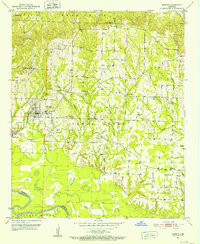
1951 Map of Horatio
USGS Topo · Published 1952About this map
Horatio serves as the primary rail and commerce hub for this corner of Sevier County, situated along the Kansas City Southern railroad. The landscape to the east and south transitions into the bottomlands of the Little River, where the Sevier Co Little River Co boundary follows the winding river channel. Rural life in the early 1950s is deeply rooted in a network of small communities and family landmarks, such as Neal Springs and Central.
Find a feature on this map
36 named features on this map. Tap any name to fly to it.
Don’t see what you’re looking for? This feature index may not catch every label — zoom into the map to look around manually.
Map Details
Editions of this 1951 Horatio Map
3 editions found
Other maps of this area

1913 · De Queen
USGS Topo · 1:125,000

1950 · Mcalester
USGS Topo · 1:250,000

1950 · Falls Chapel
USGS Topo · 1:24,000

1950 · Winthrop
USGS Topo · 1:24,000

1951 · Winthrop
USGS Topo · 1:24,000

1951 · Falls Chapel
USGS Topo · 1:24,000

1951 · Arkinda
USGS Topo · 1:24,000

1951 · Cerrogordo
USGS Topo · 1:24,000

1951 · Horatio
USGS Topo · 1:24,000

1951 · Lockesburg
USGS Topo · 1:24,000