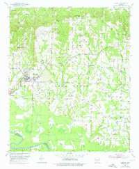
1951 Map of Horatio
USGS Topo · Published 1976About this map
The town of Horatio serves as the central hub of this mid-century survey, situated at the intersection of the Kansas City Southern railroad and several regional routes. The landscape transitions from the higher ground of Bear Creek in the north to the meandering path of the Little River, which defines the border between Sevier and Little River counties. Local life in this era is etched into the landscape through numerous country churches and cemeteries, such as Boggy Springs Ch, Bradley Chapel, and the Clear Creek Cem.
Find a feature on this map
30 named features on this map. Tap any name to fly to it.
Don’t see what you’re looking for? This feature index may not catch every label — zoom into the map to look around manually.
Map Details
Editions of this 1951 Horatio Map
3 editions found
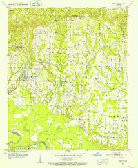
Other maps of this area

1913 · De Queen
USGS Topo · 1:125,000

1950 · Mcalester
USGS Topo · 1:250,000

1950 · Falls Chapel
USGS Topo · 1:24,000

1950 · Winthrop
USGS Topo · 1:24,000

1951 · Winthrop
USGS Topo · 1:24,000

1951 · Falls Chapel
USGS Topo · 1:24,000

1951 · Arkinda
USGS Topo · 1:24,000

1951 · Cerrogordo
USGS Topo · 1:24,000

1951 · Horatio
USGS Topo · 1:24,000

1951 · Lockesburg
USGS Topo · 1:24,000