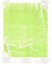
1953 Map of Horcado Ranch
USGS Topo · Published 1978About this map
San Ildefonso Pueblo Grant and the adjacent Jacona Grant define this landscape north of Santa Fe, where the terrain is carved by a network of seasonal watercourses. The map documents a complex overlay of historic land grants, including the Pojoaque Pueblo Grant and the Tesuque Pueblo Grant, illustrating how colonial and indigenous boundaries persist into the mid-20th century.
Find a feature on this map
30 named features on this map. Tap any name to fly to it.
Don’t see what you’re looking for? This feature index may not catch every label — zoom into the map to look around manually.
Map Details
Editions of this 1953 Horcado Ranch Map
5 editions found

Other maps of this area

1889 · Santa Fe
USGS Topo · 1:125,000

1892 · Santa Clara
USGS Topo · 1:125,000

1894 · Santa Fe
USGS Topo · 1:125,000

1951 · Agua Fria
USGS Topo · 1:24,000

1952 · Santa Fe
USGS Topo · 1:24,000

1952 · White Rock
USGS Topo · 1:24,000

1952 · Puye
USGS Topo · 1:24,000

1952 · Montoso Peak
USGS Topo · 1:24,000

1953 · Tesuque
USGS Topo · 1:24,000

1953 · Espanola
USGS Topo · 1:24,000