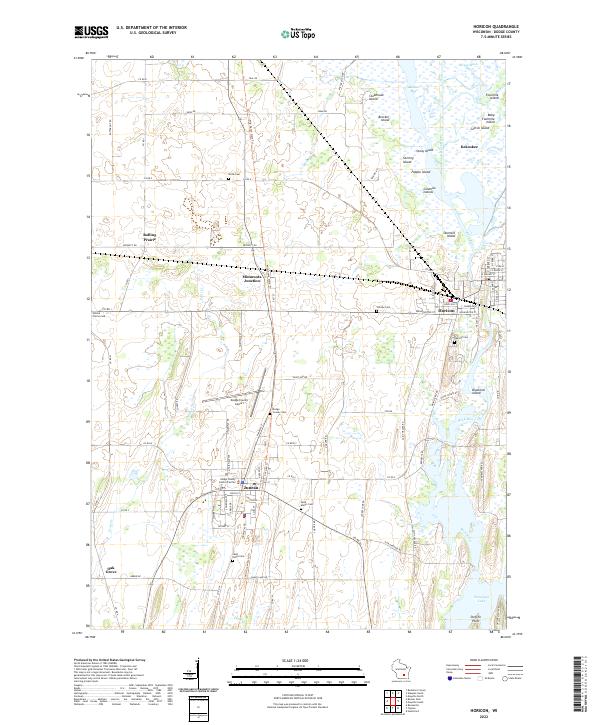
2022 Map of Horicon
USGS Topo · Published 2022About this map
Horicon Marsh dominates the northern reaches of this Dodge County landscape, where the West Branch Rock River feeds into a network of wetlands and islands including Clubhouse Island and Popple Island. The area is defined by its small agricultural and administrative hubs, with the city of Juneau serving as the county seat, complete with the Dodge County Justice Facility and the Dodge County Airport. To the east, Horicon sits at the head of the Rock River, which winds southward toward Sinissippi Lake at Steffen Point.
Find a feature on this map
87 named features on this map. Tap any name to fly to it.
Don’t see what you’re looking for? This feature index may not catch every label — zoom into the map to look around manually.
Map Details
Editions of this 2022 Horicon Map
This is the sole edition of this map. No revisions or reprints were ever made.
Other maps of this area

1955 · Beaver Dam
USGS Topo · 1:62,500

1955 · Waupun
USGS Topo · 1:62,500

1955 · Fox Lake
USGS Topo · 1:62,500

1955 · Horicon
USGS Topo · 1:62,500

1957 · Madison
USGS Topo · 1:250,000

1960 · Madison
USGS Topo · 1:250,000

1975 · Horicon NW
USGS Topo · 1:24,000

1975 · Beaver Dam NE
USGS Topo · 1:24,000
1975 · Horicon NE
USGS Topo · 1:24,000
1975 · Waupun SE
USGS Topo · 1:24,000