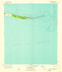
1960 Map of Horn Island East
USGS Topo · Published 1961About this map
Horn Island National Wildlife Refuge serves as the focal point of this coastal survey, illustrating the narrow barrier island chain that separates the Mississippi Sound from the open Gulf of Mexico. The map details the shifting sands and shallow shoals of the Mississippi coast during the early 1960s, including the eastern tip of Horn Island and the western edge of Petit Bois Island. Navigational features are prominent, specifically the Pascagoula Channel and Horn Island Pass, which provide vital corridors for maritime traffic. The survey highlights the ecological and geomorphic transition of these islands, which were mapped by planetable in 1941 and revised shortly before publication to reflect the changing bathymetry and shoreline typical of this hurricane-prone region of Jackson County.
Find a feature on this map
7 named features on this map. Tap any name to fly to it.
Don’t see what you’re looking for? This feature index may not catch every label — zoom into the map to look around manually.
Map Details
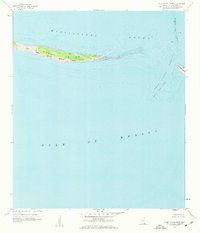
Editions of this 1960 Horn Island East Map
2 editions found
Other maps of this area

1921 · Grand Bay
USGS Topo · 1:62,500

1921 · Petit Bois Island
USGS Topo · 1:62,500

1941 · Horn Island
USGS Topo · 1:62,500

1942 · Petit Bois Island
USGS Topo · 1:62,500

1942 · Horn Island
USGS Topo · 1:62,500

1943 · Pascagoula
USGS Topo · 1:62,500

1943 · Grand Bay
USGS Topo · 1:62,500

1953 · Mobile
USGS Topo · 1:250,000

1955 · Pascagoula
USGS Topo · 1:62,500

1957 · Mobile
USGS Topo · 1:250,000