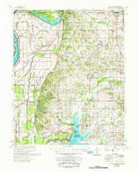
1961 Map of Horn Lake
USGS Topo · Published 1978About this map
The Mississippi River and the sweeping curve of Horn Lake define this 1961 landscape along the border of Tennessee and Mississippi. This era captures the transition of the northern Mississippi Delta, where historical agricultural patterns meet early mid-century infrastructure. Numerous small rural communities like Walls, Glover, and Lakeside are anchored by an extensive network of country churches, including Antioch Ch and Morning Star Ch, reflecting the deep-rooted social fabric of the region.
Find a feature on this map
86 named features on this map. Tap any name to fly to it.
Don’t see what you’re looking for? This feature index may not catch every label — zoom into the map to look around manually.
Map Details
Editions of this 1961 Horn Lake Map
This is the sole edition of this map. No revisions or reprints were ever made.
Other maps of this area

1908 · Hollywood
USGS Topo · 1:24,000

1908 · Lake Cormorant
USGS Topo · 1:24,000

1912 · Lake Cormorant
USGS Topo · 1:31,680

1913 · Hollywood
USGS Topo · 1:31,680

1916 · Memphis
USGS Topo · 1:62,500

1925 · Memphis
USGS Topo · 1:48,000

1927 · Memphis
USGS Topo · 1:62,500

1931 · Horseshoe Lake
USGS Topo · 1:62,500

1932 · Horn Lake
USGS Topo · 1:48,000

1932 · Crenshaw
USGS Topo · 1:62,500