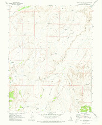
1969 Map of Horn Silver Gulch
USGS Topo · Published 1973About this map
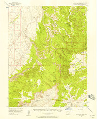
Arid basin landscapes and intricate erosion patterns dominate this Emery County survey area, where ephemeral water sources are vital to the local geography. Small-scale water management is evident through features like South Sand Reservoir, Red Point Reservoir, and the curiously named Cinderella Reservoir. The terrain is defined by dramatic elevation changes along the Rim and the Ledges, with complex drainage networks including Horn Silver Gulch and Salt Wash carving through the plateau.
Find a feature on this map
28 named features on this map. Tap any name to fly to it.
Don’t see what you’re looking for? This feature index may not catch every label — zoom into the map to look around manually.
Map Details
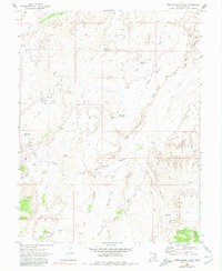
Editions of this 1969 Horn Silver Gulch Map
2 editions found
Other maps of this area

1885 · San Rafael
USGS Topo · 1:250,000

1885 · Manti
USGS Topo · 1:250,000

1885 · Fish Lake
USGS Topo · 1:250,000

1886 · Price River
USGS Topo · 1:250,000

1895 · Manti
USGS Topo · 1:250,000

1896 · Price River
USGS Topo · 1:250,000

1896 · Fish Lake
USGS Topo · 1:250,000
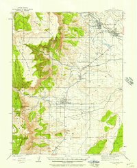
1923 · Castle Dale
USGS Topo · 1:62,500
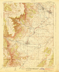
1925 · Castle Dale
USGS Topo · 1:62,500
1952 · San Rafael Knob
USGS Topo · 1:62,500