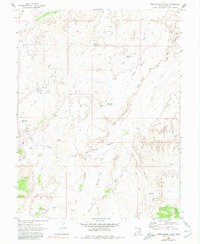
1969 Map of Horn Silver Gulch
USGS Topo · Published 1980About this map
Horn Silver Gulch and the surrounding high desert of Emery County appear here as they were documented in the late 1960s, a landscape defined by seasonal water management and isolated resource extraction. The map reveals an intricate network of water features critical for land use in this arid environment, including South Sand Reservoir, Red Point Reservoir, and the curiously named Cinderella Reservoir. Named springs and seeps like Hendrick Spring and Molen Seep mark the rare permanent water sources that sustained local travelers and livestock.
Find a feature on this map
26 named features on this map. Tap any name to fly to it.
Don’t see what you’re looking for? This feature index may not catch every label — zoom into the map to look around manually.
Map Details
Editions of this 1969 Horn Silver Gulch Map
2 editions found
Other maps of this area

1885 · San Rafael
USGS Topo · 1:250,000

1885 · Manti
USGS Topo · 1:250,000

1885 · Fish Lake
USGS Topo · 1:250,000

1886 · Price River
USGS Topo · 1:250,000

1895 · Manti
USGS Topo · 1:250,000

1896 · Price River
USGS Topo · 1:250,000

1896 · Fish Lake
USGS Topo · 1:250,000

1923 · Castle Dale
USGS Topo · 1:62,500

1925 · Castle Dale
USGS Topo · 1:62,500

1952 · San Rafael Knob
USGS Topo · 1:62,500