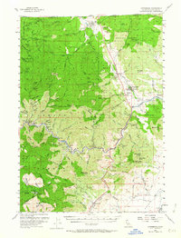
1955 Map of Hornbrook
USGS Topo · Published 1964About this map
Klamath River gold mining and timber interests define this mid-century survey of the California-Oregon borderlands. The landscape is a network of named bars and mining camps, where Masonic Bar and McConnell Bar sit along the river's edge, and numerous operations like the Sterling Mine and Cinnabar Mine are tucked into the steep drainages. The Southern Pacific railroad and the Pacific Highway run parallel through the narrow valley floor, connecting the settlements of Hilt, Henley, and Hornbrook. Historical markers for Quarantine Sta and Jefferson Davis indicate the region's significance as a gateway between states. High-altitude landmarks such as China Peak and Cottonwood Pk tower over the Shasta and Klamath national forests, while small rural education hubs like Honolulu School and Mono Sch serve the scattered population.
Find a feature on this map
116 named features on this map. Tap any name to fly to it.
Don’t see what you’re looking for? This feature index may not catch every label — zoom into the map to look around manually.
Map Details
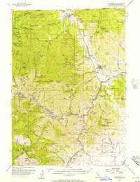
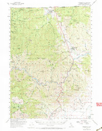
Editions of this 1955 Hornbrook Map
3 editions found
Other maps of this area

1886 · Shasta
USGS Topo · 1:250,000

1891 · Ashland
USGS Topo · 1:250,000

1893 · Ashland
USGS Topo · 1:250,000

1894 · Shasta
USGS Topo · 1:250,000

1897 · Ashland
USGS Topo · 1:250,000

1922 · Shasta Valley Sheet No 4
USGS Topo · 1:24,000

1922 · Shasta Valley Sheet No 3
USGS Topo · 1:24,000

1922 · Shasta Valley Sheet No 15
USGS Topo · 1:24,000

1922 · Shasta Valley Sheet No 14
USGS Topo · 1:24,000

1922 · Shasta Valley Sheet No 5
USGS Topo · 1:24,000