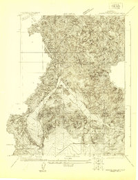
1955 Map of Hornbrook
USGS Topo · Published 1972About this map
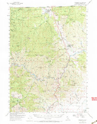
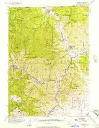
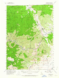
The Klamath National Forest dominates this northern California landscape, where the Klamath River snakes through deep canyons north of Hawkinsville. This survey reveals a region defined by its 20th-century extractive industries and transport corridors, from the Southern Pacific railroad line following Cottonwood Creek to the numerous gold and mineral claims scattered across the hills. Local mining history is well-represented by labels for the Siskiyou Mine, Cinnabar Mine, and several riverfront bars like Masonic Bar and Skeahan Bar. Near the Oregon border, the town of Hilt and the roadside settlement of Hornbrook serve as hubs along the path of U.S. 99. These communities were essential waypoints for travelers and workers, supported by infrastructure like the Honolulu School and the Humbug Guard Sta. The map also captures small landmarks of the era, including the Jefferson Davis Historical Marker and a Quarantine Sta Historical Marker north of Henley.
Find a feature on this map
139 named features on this map. Tap any name to fly to it.
Don’t see what you’re looking for? This feature index may not catch every label — zoom into the map to look around manually.
Map Details
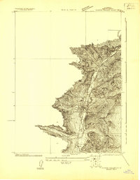
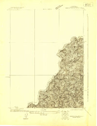
Editions of this 1955 Hornbrook Map
3 editions found
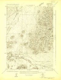
Other maps of this area

1886 · Shasta
USGS Topo · 1:250,000

1891 · Ashland
USGS Topo · 1:250,000

1893 · Ashland
USGS Topo · 1:250,000

1894 · Shasta
USGS Topo · 1:250,000

1897 · Ashland
USGS Topo · 1:250,000
1922 · Shasta Valley Sheet No 4
USGS Topo · 1:24,000
1922 · Shasta Valley Sheet No 3
USGS Topo · 1:24,000
1922 · Shasta Valley Sheet No 15
USGS Topo · 1:24,000
1922 · Shasta Valley Sheet No 14
USGS Topo · 1:24,000
1922 · Shasta Valley Sheet No 5
USGS Topo · 1:24,000