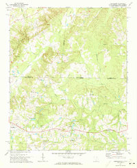
1971 Map of Hornsboro
USGS Topo · Published 1973About this map
The town of Pageland anchors the southwestern portion of this topographic survey, where a prominent Substation and Union Hill Ch mark the edge of the community. This 1971 study reveals a landscape defined by the interstate border between Union and Anson counties in North Carolina and Chesterfield County in South Carolina. The region is heavily intersected by a network of waterways including Brown Creek, Thompson Creek, and Deep Creek, which dictate the placement of rural landmarks like the Hutsey Millpond. Local faith and community life are well-represented through numerous historic meeting places such as Mt Moriah Ch, Salem Ch, and Wesley Chapel. Moving toward the settlement of Hornsboro, the terrain transitions into a more industrial profile with several Sandpits and a Quarry dotting the hills. For genealogists, the map provides precise locations for family-named grounds such as the Meltonville Cem and Ellen Grove Ch.
Find a feature on this map
39 named features on this map. Tap any name to fly to it.
Don’t see what you’re looking for? This feature index may not catch every label — zoom into the map to look around manually.
Map Details
Editions of this 1971 Hornsboro Map
2 editions found
Other maps of this area

1941 · Spartanburg
USGS Topo · 1:250,000

1953 · Spartanburg
USGS Topo · 1:250,000

1960 · Spartanburg
USGS Topo · 1:250,000

1963 · Spartanburg
USGS Topo · 1:250,000

1964 · Spartanburg
USGS Topo · 1:250,000

1968 · Ruby
USGS Topo · 1:24,000

1968 · Jefferson
USGS Topo · 1:24,000

1968 · Jefferson NE
USGS Topo · 1:24,000

1970 · Marshville
USGS Topo · 1:24,000
1970 · Wingate
USGS Topo · 1:24,000