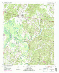
1950 Map of Hornsby
USGS Topo · Published 1981About this map
Hornsby serves as the primary hub of this 1950 landscape, positioned where the Illinois Central railroad crosses the fertile drainage basins of the Hatchie River. The terrain is defined by the broad expanse of The Big Bottom, a network of sloughs and ditches that suggests a history of land management and drainage to reclaim the river valley for agriculture. Outside the central floodplain, the map reveals a rural topography dotted with neighborhood institutions like Walnut Grove School and Brints Chapel, which anchored small farming communities before the mid-century transition. Numerous family-named burial sites, including Wyatt Cem and Stanley Cem, are scattered across the rising ground east of the river, providing critical geographic markers for genealogists tracing ancestral homesteads in Hardeman and McNairy Counties.
Find a feature on this map
35 named features on this map. Tap any name to fly to it.
Don’t see what you’re looking for? This feature index may not catch every label — zoom into the map to look around manually.
Map Details
Editions of this 1950 Hornsby Map
3 editions found
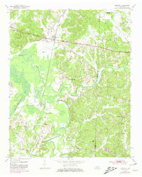
Other maps of this area

1950 · Pocahontas
USGS Topo · 1:24,000

1950 · Hebron
USGS Topo · 1:24,000

1950 · Hornsby
USGS Topo · 1:24,000

1950 · Middleton
USGS Topo · 1:24,000

1951 · Middleton
USGS Topo · 1:24,000

1951 · Hebron
USGS Topo · 1:24,000

1951 · Hornsby
USGS Topo · 1:24,000

1951 · Chewalla
USGS Topo · 1:24,000

1951 · Rose Creek
USGS Topo · 1:24,000

1952 · Pocahontas
USGS Topo · 1:24,000