
1943 Map of Horry
USGS Topo · Published 1962About this map
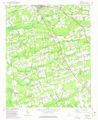
Aynor serves as the primary hub in the northern section of this interior landscape, which is defined by an intricate network of wetlands like Chinners Swamp and Brunson Swamp. The terrain is marked by traditional Lowcountry agricultural patterns, where farm clearings are frequently interrupted by the winding paths of Spring Swamp and Knotty Branch. The distribution of rural life is visible through small community nodes such as Jones Crossroads and Salem Crossroads, often anchored by local gathering places like Bullock Chapel or Pisgah Ch.
Find a feature on this map
40 named features on this map. Tap any name to fly to it.
Don’t see what you’re looking for? This feature index may not catch every label — zoom into the map to look around manually.
Map Details
Editions of this 1943 Horry Map
2 editions found
Other maps of this area

1943 · Dongola
USGS Topo · 1:24,000

1943 · Adrian
USGS Topo · 1:24,000

1943 · Conway
USGS Topo · 1:24,000

1944 · Adrian
USGS Topo · 1:31,680

1946 · Johnsonville
USGS Topo · 1:62,500

1947 · Centenary
USGS Topo · 1:24,000

1948 · Galivants Ferry
USGS Topo · 1:24,000

1948 · Bayboro
USGS Topo · 1:24,000

1949 · Bayboro
USGS Topo · 1:24,000

1949 · Georgetown
USGS Topo · 1:250,000