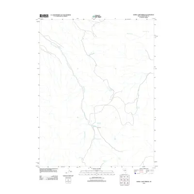
2012 Map of Horse Camp Springs
USGS Topo · Published 2012About this map
Horse Camp anchors this high-desert landscape in White Pine County, centered on a critical network of water sources essential for life in the Great Basin. The hydrology is dominated by the long path of Horse Camp Wash, which is fed by numerous named seeps including North Horse Camp Spring and South Horse Camp Spring. This area reflects a traditional ranching or livestock-herding geography, evidenced by the presence of Horse Camp Reservoir and the appropriately named Cattle Camp Wash. The naming of features like Bennett Spring, Stevens Spring, and John Henry Wash suggests a history tied to specific individuals or families who utilized these isolated water points. The map provides a detailed look at how intermittent drainages and permanent springs dictate the human and animal footprint in this arid region.
Find a feature on this map
17 named features on this map. Tap any name to fly to it.
Don’t see what you’re looking for? This feature index may not catch every label — zoom into the map to look around manually.
Map Details
Editions of this 2012 Horse Camp Springs Map
This is the sole edition of this map. No revisions or reprints were ever made.
Other maps of this area

1952 · Ely
USGS Topo · 1:125,000

1956 · Lund
USGS Topo · 1:250,000

1956 · Ely
USGS Topo · 1:250,000

1958 · Ely
USGS Topo · 1:62,500

1959 · Ely
USGS Topo · 1:250,000

1959 · Connors Pass
USGS Topo · 1:62,500

1960 · Lund
USGS Topo · 1:250,000

1963 · Ely
USGS Topo · 1:250,000
1973 · White Rock Creek
USGS Topo · 1:24,000

1973 · Cattle Camp Spring
USGS Topo · 1:24,000