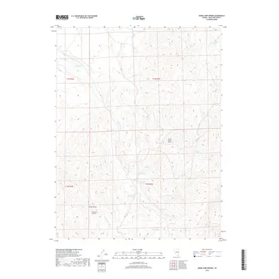
2018 Map of Horse Camp Springs
USGS Topo · Published 2018About this map
The Schell Creek Range dominates this portion of White Pine County, characterized by a complex network of seasonal drainages and essential water sources. Horse Camp Springs and its related features, including North Horse Camp Spring and South Horse Camp Spring, indicate the historical importance of this area for livestock and resource management in the high desert. The presence of Horse Camp Reservoir and named washes like Cattle Camp Wash and John Henry Wash further illustrate the infrastructure required to manage water across this arid landscape. Topographically, the map reveals deep incisions such as Basque Canyon and Monument Canyon, while numerous individual springs like Stevens Spring, Bennett Spring, and Limerock Spring mark vital points of interest for those tracing the history of land use and surveying in rural Nevada.
Find a feature on this map
23 named features on this map. Tap any name to fly to it.
Don’t see what you’re looking for? This feature index may not catch every label — zoom into the map to look around manually.
Map Details
Editions of this 2018 Horse Camp Springs Map
This is the sole edition of this map. No revisions or reprints were ever made.
Other maps of this area

1952 · Ely
USGS Topo · 1:125,000

1956 · Lund
USGS Topo · 1:250,000

1956 · Ely
USGS Topo · 1:250,000

1958 · Ely
USGS Topo · 1:62,500

1959 · Ely
USGS Topo · 1:250,000

1959 · Connors Pass
USGS Topo · 1:62,500

1960 · Lund
USGS Topo · 1:250,000

1963 · Ely
USGS Topo · 1:250,000
1973 · White Rock Creek
USGS Topo · 1:24,000

1973 · Cattle Camp Spring
USGS Topo · 1:24,000