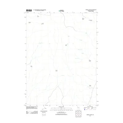
2011 Map of Horse Canyon
USGS Topo · Published 2011About this map
Horse Canyon Spring and a series of high-desert water sources define this arid landscape in Washoe County. The area is characterized by a complex drainage system where Trail Canyon, Crooked Canyon, and Horse Canyon carve through the high ground surrounding Burnt Mountain. This 2011 survey reveals a territory reliant on scattered springs for both wildlife and historical livestock management, as seen in the naming of Company 40 Spring and Company Spring. These named water points, alongside Willow Spring and Mud Spring, are concentrated within natural depressions like Willow Basin and Little Sawmill Basin. The terrain is marked by dramatic elevation changes where canyons such as Little Sawmill Canyon and Five Springs Canyon provide the primary geographic structure in this corner of Nevada.
Find a feature on this map
19 named features on this map. Tap any name to fly to it.
Don’t see what you’re looking for? This feature index may not catch every label — zoom into the map to look around manually.
Map Details
Editions of this 2011 Horse Canyon Map
This is the sole edition of this map. No revisions or reprints were ever made.
Other maps of this area

1886 · Granite Range
USGS Topo · 1:250,000

1894 · Granite Range
USGS Topo · 1:250,000

1955 · Lovelock
USGS Topo · 1:250,000

1959 · Lovelock
USGS Topo · 1:250,000

1980 · Salt Marsh
USGS Topo · 1:24,000
1980 · Buffalo Creek
USGS Topo · 1:24,000

1980 · Hog Spring
USGS Topo · 1:24,000

1980 · Wall Spring
USGS Topo · 1:24,000

1980 · Smith Canyon
USGS Topo · 1:24,000
1981 · Eddies Garden
USGS Topo · 1:24,000