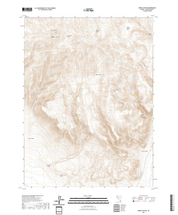
2021 Map of Horse Canyon
USGS Topo · Published 2021About this map
Smoke Creek Desert defines the southern extent of this high-altitude landscape in Washoe County, where the desert floor meets a complex network of canyons and drainage basins. The area is characterized by its vital water sources, including Horse Canyon Spring, Granite Spring, and the curiously named Company 40 Spring. These springs and seasonal drainages, such as Five Springs Canyon and Little Sawmill Canyon, reveal a terrain shaped by water management and transit needs in an arid environment. Near Burnt Mtn, the land drops into narrow corridors like Crooked Canyon and Trail Canyon, which provided historical passage through the elevation changes. The presence of Surprise Valley Rd in the southeast corner marks the primary modern route through this high-desert basin and range country.
Find a feature on this map
27 named features on this map. Tap any name to fly to it.
Don’t see what you’re looking for? This feature index may not catch every label — zoom into the map to look around manually.
Map Details
Editions of this 2021 Horse Canyon Map
This is the sole edition of this map. No revisions or reprints were ever made.
Other maps of this area

1886 · Granite Range
USGS Topo · 1:250,000

1894 · Granite Range
USGS Topo · 1:250,000

1955 · Lovelock
USGS Topo · 1:250,000

1959 · Lovelock
USGS Topo · 1:250,000

1980 · Salt Marsh
USGS Topo · 1:24,000
1980 · Buffalo Creek
USGS Topo · 1:24,000

1980 · Hog Spring
USGS Topo · 1:24,000

1980 · Wall Spring
USGS Topo · 1:24,000

1980 · Smith Canyon
USGS Topo · 1:24,000
1981 · Eddies Garden
USGS Topo · 1:24,000