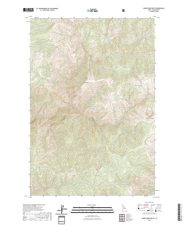
2024 Map of Horse Creek Butte
USGS Topo · Published 2024About this map
Frank Church-River of No Return Wilderness and Salmon National Forest converge in this high-elevation Idaho landscape, where the drainage systems of Horse Creek and Cayuse Creek define the central topography. The terrain is marked by prominent crests such as Roan Ridge and Long Tom Ridge, while the eastern portion of the sheet is anchored by Horse Creek Butte. A network of backcountry access routes, including the Reynolds Creek Trl and Cayuse Creek Trl, connects isolated points of interest like Quicksand Bog and the high-altitude Corn Lake. This modern survey reflects the enduring character of a region where the primary development consists of Forest Service infrastructure, such as FR 065 and FR 166, intended to navigate the complex drainage patterns of Mustang Creek and Little Horse Creek.
Find a feature on this map
37 named features on this map. Tap any name to fly to it.
Don’t see what you’re looking for? This feature index may not catch every label — zoom into the map to look around manually.
Map Details
Editions of this 2024 Horse Creek Butte Map
This is the sole edition of this map. No revisions or reprints were ever made.
Other maps of this area

1956 · Elk City
USGS Topo · 1:250,000

1960 · Elk City
USGS Topo · 1:250,000

1960 · Painted Rocks Lake
USGS Topo · 1:62,500

1960 · Shoup
USGS Topo · 1:62,500

1962 · Wood Hump
USGS Topo · 1:24,000

1962 · Blue Joint
USGS Topo · 1:24,000

1962 · Square Top
USGS Topo · 1:24,000

1962 · Long Tom Mtn
USGS Topo · 1:24,000

1962 · Horse Creek Butte
USGS Topo · 1:24,000

1962 · Butts Creek Point
USGS Topo · 1:24,000