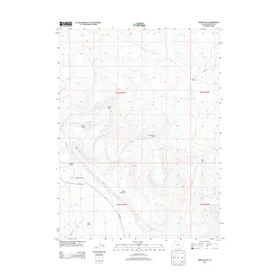
2013 Map of Horse Gulch
USGS Topo · Published 2013About this map
The Yampa River carves a winding path through the high desert of Moffat County, defining the drainage patterns of a landscape marked by deep gulches and prominent elevations. This 2013 survey illustrates the rugged physical geography of the Axial Basin and the significant mass of Duffy Mountain, which dominates the southern half of the quadrangle. Human activity in this portion of Colorado is sparse, centered on ranching and infrastructure such as the Culverwell Ranch and the Duffy Tunnel. The terrain is deeply incised by numerous seasonal watercourses, including Horse Gulch, Sand Spring Gulch, and Morgan Gulch. Notable landmarks like Signal Butte provide vertical relief against the wide basins, while Co Road 17 serves as a primary transit corridor through the southern reaches, connecting the isolated ranching properties and geographic features of the region.
Find a feature on this map
20 named features on this map. Tap any name to fly to it.
Don’t see what you’re looking for? This feature index may not catch every label — zoom into the map to look around manually.
Map Details
Editions of this 2013 Horse Gulch Map
This is the sole edition of this map. No revisions or reprints were ever made.
Other maps of this area

1910 · Danforth Hills
USGS Topo · 1:125,000

1912 · Axial
USGS Topo · 1:62,500

1914 · Axial
USGS Topo · 1:62,500

1915 · Monument Butte
USGS Topo · 1:62,500

1916 · Craig
USGS Topo · 1:125,000

1954 · Craig
USGS Topo · 1:250,000

1957 · Craig
USGS Topo · 1:250,000

1958 · Craig
USGS Topo · 1:250,000

1960 · Craig
USGS Topo · 1:250,000

1962 · Craig
USGS Topo · 1:250,000