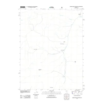
2012 Map of Horse Heaven Mountain
USGS Topo · Published 2012About this map
Horse Heaven Mountain dominates the central portion of this High Desert landscape in Nye County. Water sources dictate the pattern of human activity here, with named sites like Seep Spring, Sheep Spring, and Laxague Spring punctuating the arid terrain of the Monitor Range. The presence of the Martin Ranch and the locality of Horse Heaven suggest a history tied to livestock and remote outposts, where seasonal drainages like Copenhagen Cr and Sweeney Wash provide the primary geographical structure. Significant topographical markers such as Rabbit Hill and Martin Ridge offer orientation across a landscape defined by deep-cut canyons, including Copenhagen Canyon and Whiterock Canyon.
Find a feature on this map
16 named features on this map. Tap any name to fly to it.
Don’t see what you’re looking for? This feature index may not catch every label — zoom into the map to look around manually.
Map Details
Editions of this 2012 Horse Heaven Mountain Map
This is the sole edition of this map. No revisions or reprints were ever made.
Other maps of this area

1926 · Roberts Mountains
USGS Topo · 1:250,000

1929 · Roberts Mountains
USGS Topo · 1:250,000

1955 · Millett
USGS Topo · 1:250,000

1956 · Horse Heaven Mtn
USGS Topo · 1:62,500

1956 · Antelope Peak
USGS Topo · 1:62,500

1959 · Millett
USGS Topo · 1:250,000

1960 · Hickison Summit
USGS Topo · 1:62,500

1960 · Dianas Punch Bowl
USGS Topo · 1:62,500

1978 · Summit Mountain
USGS Topo · 1:100,000
1989 · Ninemile Peak
USGS Topo · 1:24,000