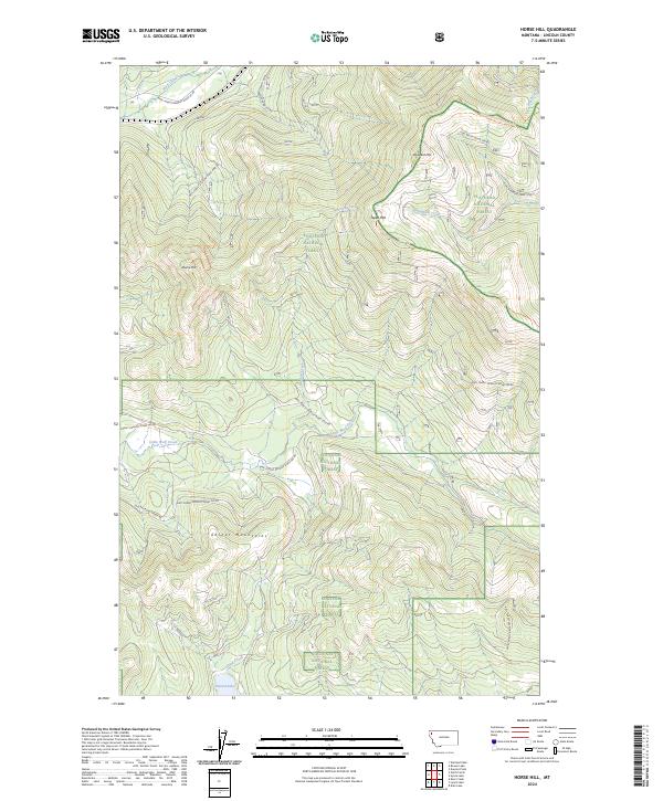
2024 Map of Horse Hill
USGS Topo · Published 2024About this map
The Cabinet Mountains define the southern landscape of this Lincoln County survey, where the peaks of Horse Hill and Tepee Mtn rise between the drainages of Little Wolf Creek and Sinclair Creek. This high-country region is largely contained within the Kootenai National Forest, with its eastern boundary reaching into the Flathead National Forest.
Find a feature on this map
30 named features on this map. Tap any name to fly to it.
Don’t see what you’re looking for? This feature index may not catch every label — zoom into the map to look around manually.
Map Details
Editions of this 2024 Horse Hill Map
This is the sole edition of this map. No revisions or reprints were ever made.
Other maps of this area

1920 · Jennings
USGS Topo · 1:125,000

1935 · Thompson Lakes
USGS Topo · 1:96,000

1942 · Thompson Lakes
USGS Topo · 1:125,000

1957 · Kalispell
USGS Topo · 1:250,000

1960 · Kalispell
USGS Topo · 1:250,000

1961 · Kalispell
USGS Topo · 1:250,000

1963 · Wolf Prairie
USGS Topo · 1:24,000

1963 · Warland Peak
USGS Topo · 1:24,000

1963 · Sylvia Lake
USGS Topo · 1:24,000
1963 · Bowen Lake
USGS Topo · 1:24,000