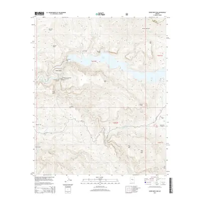
2014 Map of Horse Mesa Dam
USGS Topo · Published 2014About this map
Horse Mesa Dam anchors this section of the Salt River canyon, where the impounded waters of the Salt River create the winding expanse of Apache Lake. Located within the Tonto National Forest, the landscape is defined by massive geological formations including the Walls of Bronze and the Mazatzal Mountains. The historic Apache Trl winds through the southern portion of the map, tracing the high ridges above Fish Creek Canyon and Mesquite Flat. This 2014 survey illustrates the complex intersection of early 20th-century water management infrastructure and the natural desert terrain, featuring numerous springs such as Cottonwoods Spring and Indian Spring that support the local ecosystem. Notable landmarks like Black Cross Butte and Coronado Mesa serve as distinct navigational points within this protected wilderness area.
Find a feature on this map
42 named features on this map. Tap any name to fly to it.
Don’t see what you’re looking for? This feature index may not catch every label — zoom into the map to look around manually.
Map Details
Editions of this 2014 Horse Mesa Dam Map
This is the sole edition of this map. No revisions or reprints were ever made.
Other maps of this area

1900 · Florence
USGS Topo · 1:125,000

1902 · Florence
USGS Topo · 1:125,000

1907 · Roosevelt
USGS Topo · 1:125,000

1909 · Four Peaks
USGS Topo · 1:125,000

1912 · Roosevelt
USGS Topo · 1:125,000

1948 · Superior
USGS Topo · 1:62,500

1948 · Iron Mountain
USGS Topo · 1:24,000

1949 · Iron Mountain
USGS Topo · 1:24,000

1954 · Mesa
USGS Topo · 1:250,000

1956 · Goldfield
USGS Topo · 1:24,000