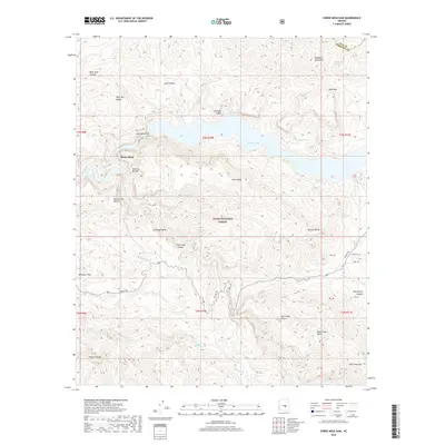
2018 Map of Horse Mesa Dam
USGS Topo · Published 2018About this map
Horse Mesa Dam anchors this section of the Salt River canyon system, impounding the waters of Apache Lake within the Tonto National Forest. The landscape is defined by massive geological formations, including the sheer Painted Cliffs and the appropriately named Walls of Bronze. Transportation through this difficult terrain is dominated by the historic Apache Trl, which winds along the southern elevations above Fish Creek Canyon and Mesquite Flat. This 2018 survey illustrates the complex relationship between water management and the natural desert environment, marking numerous water sources such as Hells Hole Spring and O'Connell Spring that have been vital to the area's utility. The map also records the boundary between Gila and Maricopa Counties at the northeastern corner of the reservoir.
Find a feature on this map
42 named features on this map. Tap any name to fly to it.
Don’t see what you’re looking for? This feature index may not catch every label — zoom into the map to look around manually.
Map Details
Editions of this 2018 Horse Mesa Dam Map
This is the sole edition of this map. No revisions or reprints were ever made.
Other maps of this area

1900 · Florence
USGS Topo · 1:125,000

1902 · Florence
USGS Topo · 1:125,000

1907 · Roosevelt
USGS Topo · 1:125,000

1909 · Four Peaks
USGS Topo · 1:125,000

1912 · Roosevelt
USGS Topo · 1:125,000

1948 · Superior
USGS Topo · 1:62,500

1948 · Iron Mountain
USGS Topo · 1:24,000

1949 · Iron Mountain
USGS Topo · 1:24,000

1954 · Mesa
USGS Topo · 1:250,000

1956 · Goldfield
USGS Topo · 1:24,000